Last Updated: January 2025 | Reading Time: 15 minutes
Introduction
A Tesla Model S traveling at 120 km/h on the highway relies on its LiDAR sensor to detect a stopped vehicle 200 meters ahead. The sensor must accurately measure both distance (is the obstacle 200m or 205m away?) and reflectance (is it a dark-painted car at 15% or a white truck at 85%?). A 5% error in distance means emergency braking triggers 5 meters too late—potentially catastrophic at highway speeds. A misclassified reflectance could cause the system to ignore a low-reflectance pedestrian entirely.
LiDAR calibration is the foundation of autonomous driving safety. Unlike cameras that “see” the world visually, LiDAR sensors measure the physical properties of light reflection—time-of-flight for distance, return intensity for reflectance. These measurements must be traceable, repeatable, and accurate across the sensor’s full operational envelope: 0.5m to 300m range, -40°C to +85°C temperature, rain/fog/snow conditions, and targets ranging from 2% (black rubber) to 95% (retroreflective signs).
This is where diffuse reflectance standards become mission-critical. These precision optical targets provide known, stable reflectance values that enable engineers to:
- Verify sensor accuracy at various distances and reflectivities
- Calibrate intensity response curves
- Validate performance across environmental conditions
- Ensure compliance with automotive safety standards (ISO 26262, SAE J3016)
This comprehensive guide covers everything you need to perform professional-grade LiDAR calibration for automotive applications—from basic range verification to advanced multi-target dynamic testing.
What you’ll learn:
- Step-by-step LiDAR calibration procedures
- How to select reflectance levels for automotive testing
- Distance and target sizing requirements
- Indoor vs. outdoor testing best practices
- Common LiDAR wavelengths and their implications
- Real-world case studies from automotive validation
- Troubleshooting guide for calibration issues
1. Understanding LiDAR Calibration Requirements
Why LiDAR Calibration Matters
Automotive LiDAR sensors must meet stringent accuracy requirements defined by safety standards and OEM specifications:
Distance Accuracy Requirements:
- Highway autonomy (SAE Level 3+): ±2cm at 100m, ±5cm at 200m
- Urban autonomy (SAE Level 4): ±1cm at 50m
- Parking assistance: ±0.5cm at 5m
Intensity/Reflectance Accuracy:
- Must distinguish between 10% (pedestrian clothing) and 20% (vehicle tire) reflectance
- Classification accuracy: >95% across full dynamic range
- False positive rate: <0.1% (less than 1 in 1000 detections)
Angular Accuracy:
- Horizontal: ±0.1° (at 100m, 17cm positional accuracy)
- Vertical: ±0.1°
Environmental Robustness:
- Must function in rain (visibility >50m)
- Snow/fog detection capability
- Temperature stability: -40°C to +85°C
- Sunlight interference rejection (>100,000 lux)
Types of LiDAR Calibration
Factory Calibration (One-Time): Performed by sensor manufacturer before shipment:
- Optical alignment (laser emitter to receiver)
- Timing calibration (picosecond-level accuracy for ToF)
- Temperature compensation coefficients
- Beam pattern characterization
End-User Validation (Periodic): Performed by automotive OEMs/Tier-1 suppliers:
- Range accuracy verification – Does measured distance match actual?
- Intensity calibration – Does reported reflectance match known targets?
- Field of view validation – Verify angular coverage
- Environmental testing – Performance under temperature/weather extremes
This guide focuses on end-user validation using diffuse reflectance standards.
Calibration vs. Validation
Calibration: Adjusting sensor parameters to match known references
- Example: If sensor reports 49.5m when target is at 50.0m, apply +0.5m offset
Validation: Verifying sensor meets specifications without adjustment
- Example: Confirm sensor accuracy is within ±2cm at 100m (pass/fail)
For automotive safety systems: Validation is more common (sensors are factory-calibrated and sealed). If validation fails, sensor is replaced rather than adjusted in the field.
Regulatory and Standards Context
ISO 26262 (Automotive Functional Safety):
- Requires traceable calibration for all safety-critical sensors
- ASIL-D classification for autonomous driving LiDAR
- Calibration equipment must have 3-5× better accuracy than sensor under test
SAE J3016 (Levels of Driving Automation):
- Level 3+ requires redundant sensing with validated accuracy
- LiDAR often primary sensor for long-range detection (>50m)
UN Regulation No. 157 (ALKS – Automated Lane Keeping Systems):
- Requires demonstrated performance in “worst-case scenarios”
- Low-reflectance targets (10-15%) at maximum detection range
Calibration Frequency
Initial validation: Before vehicle production Periodic re-validation:
- Every 6 months during development
- Annually for production vehicles (fleet testing)
- After any sensor replacement or repair
- After environmental exposure (extreme temperature, contamination)
Degradation indicators:
- Increased false detection rate
- Reduced maximum detection range (>10% reduction)
- Intensity measurement drift (>5% change in controlled test)
2. Essential Equipment and Setup
Required Equipment
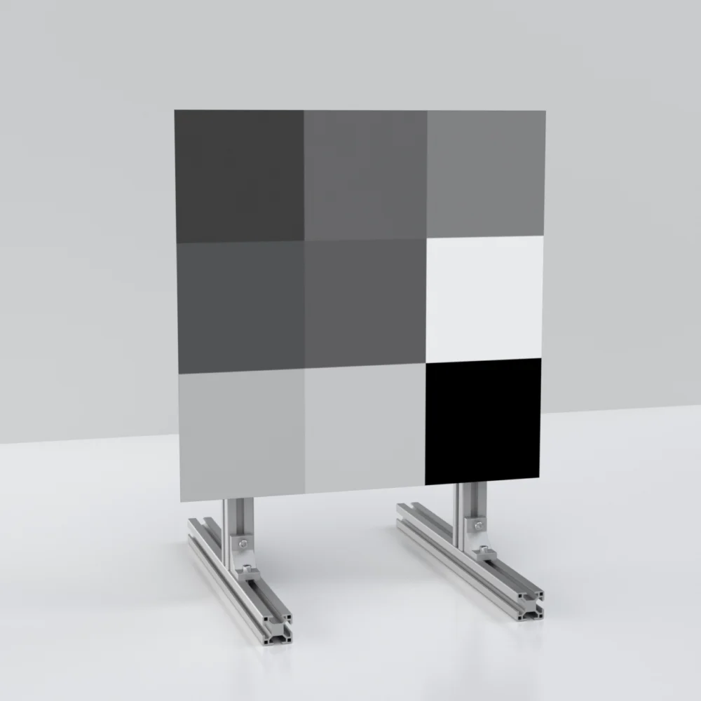
1. Diffuse Reflectance Standards
Minimum configuration (Basic validation):
- 1× 50% reflectance standard, 500×500mm
- Wavelength: Match your LiDAR (905nm or 1550nm)
- Cost: ~$800
Recommended configuration (Professional testing):
- 3× Reflectance standards: 10%, 50%, 90%
- Size: 1000×1000mm (for testing up to 100m)
- Wavelength: LiDAR-specific (DRS-L series)
- Substrate: Aluminum (outdoor-rated)
- Calibration: NIST-traceable, ±2% accuracy
- Cost: ~$3,500-5,000
Advanced configuration (Full range testing):
- 3× Large format: 2000×3000mm (for 150-300m testing)
- Additional mid-range targets: 20%, 70%
- Combination fusion targets (if testing camera-LiDAR)
- Cost: ~$10,000-15,000
2. Target Mounting System
Requirements:
- Rigid, non-vibrating mount
- Adjustable height (1-2m range typical)
- Angle adjustment: ±60° (for Lambertian conformity testing)
- Weatherproof (for outdoor testing)
Options:
- Tripod mount: Small targets (<500mm), indoor use, $100-300
- Heavy-duty stand: Medium targets (1m), indoor/outdoor, $500-1,000
- Automotive target fixture: Large targets (2-3m), outdoor, custom fabrication, $2,000-5,000
3. Distance Measurement Reference
Purpose: Establish true distance to target (ground truth)
Options:
Laser Rangefinder (Recommended):
- Accuracy: ±1mm at 100m
- Leica DISTO or Bosch GLM series
- Cost: $300-800
- Advantage: Fast, accurate, traceable
Total Station (Professional):
- Accuracy: ±0.5mm at 100m
- Surveying-grade positioning
- Cost: $5,000-20,000
- Advantage: Ultimate accuracy, angle measurement included
Tape Measure (Not recommended):
- Accuracy: ±5-10mm at 50m (sag, alignment errors)
- Only suitable for <10m calibration
- Cost: $20
- Disadvantage: Inadequate accuracy for automotive requirements
4. Environmental Monitoring
Temperature sensor:
- Measure ambient and target surface temperature
- ±0.5°C accuracy
- Data logging capability
- Cost: $50-200
Humidity sensor:
- Relative humidity measurement
- Important for outdoor testing (condensation effects)
- Cost: $30-100
Lux meter (Optional but recommended):
- Measure ambient light levels
- Verify sunlight interference conditions
- Cost: $100-500
5. Data Acquisition System
Laptop/Computer:
- Interface with LiDAR sensor (Ethernet, CAN bus, or proprietary)
- Real-time data visualization
- Data logging (point clouds, intensity values, timestamps)
Software:
- LiDAR manufacturer’s SDK/API
- Data analysis tools (MATLAB, Python with Open3D)
- Statistical analysis (Excel, Origin)
Test Environment Setup
Indoor Testing Environment:
Advantages:
- Controlled temperature (±2°C stability)
- No weather interference
- Consistent lighting
- Repeatable conditions
Requirements:
- Minimum space: 2× maximum test distance + 5m
- Example: 50m testing requires 105m facility
- Low ambient light (<100 lux) or ability to control lighting
- Non-reflective walls (avoid multipath reflections)
- Vibration-isolated floor (for precision measurements)
Limitations:
- Cannot test long-range (>100m typically)
- Does not validate outdoor performance
- Expensive to build/rent
Outdoor Testing Environment:
Advantages:
- Long-range testing (200-300m possible)
- Real-world conditions (temperature, humidity, sunlight)
- Large target mounting easier
Requirements:
- Open field or closed test track
- Flat terrain (±5cm over test distance)
- Minimal electromagnetic interference
- Safety perimeter (no public access during testing)
Challenges:
- Weather variability (need multiple test days)
- Temperature swings (morning vs afternoon)
- Wind-induced target movement
- Sunlight interference at certain angles
Hybrid Approach (Recommended):
- Indoor: Initial calibration, repeatability testing, algorithm development
- Outdoor: Validation at long range, environmental robustness testing
Safety Considerations
Laser Safety:
- Automotive LiDAR: Typically Class 1 or Class 1M (eye-safe)
- Follow manufacturer safety guidelines
- Avoid direct eye exposure at close range (<1m)
- Post warning signs in test area
Vehicle Safety (If testing on-vehicle LiDAR):
- Secure vehicle with wheel chocks
- Disable autonomous driving functions during calibration
- Clear test area of personnel during automated testing
Environmental:
- Outdoor testing: Weather contingency plans
- Lightning risk mitigation
- Heat stress precautions (summer outdoor testing)
3. Step 1: Range Calibration Procedure
Range calibration verifies that the LiDAR sensor accurately measures distance to targets.
Objective
Confirm that measured distance matches true distance within specification:
- Typical spec: ±2cm at 100m for automotive LiDAR
Test Configuration
Target:
- 90% reflectance standard (high return ensures strong signal)
- Size: Appropriate for test distance (see Section 7)
- Perpendicular to LiDAR beam axis (θ = 0°)
Distances to test:
- Close range: 2m, 5m, 10m
- Mid range: 25m, 50m, 75m
- Long range: 100m, 150m, 200m (if sensor capable)
- Adjust based on sensor specifications
Procedure
Step 1: Setup
- Position target at first test distance (e.g., 5m)
- Align target perpendicular to LiDAR (use level/inclinometer)
- Verify target is centered in LiDAR field of view
- Measure true distance with laser rangefinder:
- Measure from LiDAR aperture center to target surface
- Record: D_true = 5.000m (±1mm)
Step 2: Data Collection
- Activate LiDAR sensor
- Collect 100 consecutive scans (typically 1-10 seconds at 10-100 Hz scan rate)
- Extract distance measurements to target:
- Identify target in point cloud (brightest cluster typically)
- Calculate mean distance: D_measured = mean(100 measurements)
- Calculate standard deviation: σ = std(100 measurements)
Step 3: Analysis
- Calculate range error:
Range Error = D_measured - D_trueExample: If D_measured = 5.003m and D_true = 5.000m Range Error = +3mm (+0.003m) - Calculate range error percentage:
Range Error % = (Range Error / D_true) × 100%Example: (+0.003m / 5.000m) × 100% = +0.06% - Evaluate repeatability:
Repeatability (2σ) = 2 × σExample: If σ = 2mm, then 95% of measurements within ±4mm
Step 4: Repeat at All Distances
- Move target to next distance (10m)
- Repeat Steps 1-3
- Continue for all planned distances
Expected Results (Good Calibration)
Example data table:
| True Distance | Measured Distance | Range Error | Error % | Repeatability (2σ) | Pass/Fail |
|---|---|---|---|---|---|
| 5.000m | 5.003m | +3mm | +0.06% | ±4mm | ✓ Pass |
| 10.000m | 10.001m | +1mm | +0.01% | ±5mm | ✓ Pass |
| 25.000m | 24.998m | -2mm | -0.01% | ±8mm | ✓ Pass |
| 50.000m | 50.005m | +5mm | +0.01% | ±12mm | ✓ Pass |
| 100.000m | 100.018m | +18mm | +0.02% | ±20mm | ✓ Pass |
| 200.000m | 200.052m | +52mm | +0.03% | ±40mm | ⚠️ Borderline |
Pass Criteria:
- Range error < ±2cm at 100m
- Range error < ±5cm at 200m
- Repeatability < 5% of distance (e.g., <5cm at 100m)
Common Issues and Corrections
Issue #1: Systematic Offset
Symptom: All measurements shifted by constant amount
- Example: Every distance reads +20mm high
Cause:
- Incorrect reference point (measuring from wrong location on sensor)
- Time-of-flight zero calibration error
Solution:
- Verify measurement reference point on sensor housing
- If consistent offset, apply correction factor (software adjustment)
- For sealed sensors, this may indicate factory calibration issue → RMA
Issue #2: Distance-Dependent Error
Symptom: Error increases with distance
- Example: +5mm at 10m, +15mm at 50m, +50mm at 100m
Cause:
- Incorrect speed of light constant in firmware
- Temperature-dependent timing errors
Solution:
- Verify ambient temperature (record during testing)
- Apply temperature compensation (per manufacturer guidelines)
- If error exceeds spec, sensor may need recalibration
Issue #3: Poor Repeatability
Symptom: Large standard deviation (σ > 1% of distance)
- Example: At 50m, measurements scatter ±100mm
Causes:
- Target too small (only partial signal return)
- Target vibration (wind, unstable mount)
- Low signal-to-noise ratio (target too far or too low reflectance)
- Electrical interference
Solution:
- Use larger or higher-reflectance target
- Stabilize mounting (sandbags, guy wires)
- Move to shorter distance or higher reflectance
- Check for EMI sources (high-voltage lines, radio transmitters)
Advanced: Multi-Angle Range Calibration
For comprehensive validation, repeat range calibration with target at angles:
Test angles:
- θ = 0° (perpendicular) – baseline
- θ = ±30° (moderate angle)
- θ = ±60° (extreme angle)
Expected behavior: If target has good Lambertian properties (>95% conformity), range accuracy should be maintained at all angles.
If range error increases at angles:
- Target may have poor Lambertian conformity
- LiDAR may have angular-dependent timing errors
- Investigate and document
4. Step 2: Intensity Calibration Procedure
Intensity calibration verifies that the LiDAR correctly measures target reflectance, independent of distance.
Objective
Confirm that reported intensity correlates linearly with known reflectance:
- 10% target returns 1× intensity
- 50% target returns 5× intensity
- 90% target returns 9× intensity
The Physics: Why Intensity Calibration Matters
Laser Radar Equation:
P_received = (P_transmitted × A_receiver × ρ × σ) / (4π × R²)
Where:
- P_received = Received optical power
- P_transmitted = Transmitted laser power
- A_receiver = Receiver aperture area
- ρ = Target reflectance (0-1)
- σ = Target cross-section
- R = Distance to target
Key insight: For a given distance R, received power is directly proportional to reflectance ρ.
LiDAR intensity value (reported in point cloud) should linearly represent ρ, allowing objects to be classified:
- Low intensity (ρ = 10-20%) → Dark objects (pedestrian, tire, asphalt)
- Medium intensity (ρ = 40-60%) → Gray objects (concrete, unpainted metal)
- High intensity (ρ = 80-95%) → Bright objects (white vehicles, road signs)
Test Configuration
Targets required:
- Minimum: 10%, 50%, 90% reflectance standards
- Better: 10%, 30%, 50%, 70%, 90% (5 targets)
- Size: Same as used for range calibration
- Wavelength: Must match LiDAR (905nm or 1550nm)
Test distance:
- Fix distance for entire intensity calibration
- Typical: 50m (long enough to be representative, short enough for strong signal from 10% target)
Procedure
Step 1: Position First Target (90% reflectance)
- Place 90% target at fixed distance (e.g., 50.0m)
- Align perpendicular to LiDAR
- Collect 100 scans
- Extract intensity values from target area
- Calculate mean intensity: I_90 = mean(intensities)
- Calculate std deviation: σ_90
- Record: I_90 = 2500 (arbitrary units), σ = 80
Step 2: Swap to 50% Target
- Remove 90% target, install 50% target at exact same position
- Use laser rangefinder to verify distance unchanged
- Use same mounting hardware to ensure alignment
- Collect 100 scans
- Calculate: I_50 and σ_50
- Record: I_50 = 1380, σ = 60
Step 3: Swap to 10% Target
- Install 10% target at same position
- Collect 100 scans
- Calculate: I_10 and σ_10
- Record: I_10 = 280, σ = 35
Step 4 (Optional): Additional Reflectivities
- Repeat for 30% and 70% targets if available
Analysis
Calculate Intensity Ratios:
Expected ratios (theoretical):
- I_90 / I_10 = 90% / 10% = 9.0
- I_50 / I_10 = 50% / 10% = 5.0
- I_90 / I_50 = 90% / 50% = 1.8
Measured ratios (from example data):
- I_90 / I_10 = 2500 / 280 = 8.93 ✓
- I_50 / I_10 = 1380 / 280 = 4.93 ✓
- I_90 / I_50 = 2500 / 1380 = 1.81 ✓
Deviation from ideal:
- 8.93 vs 9.0: -0.8% error ✓ Excellent
- 4.93 vs 5.0: -1.4% error ✓ Excellent
- 1.81 vs 1.8: +0.6% error ✓ Excellent
Pass Criteria:
- All ratios within ±5% of theoretical: Good ✓
- Any ratio off by 5-10%: Acceptable ⚠️
- Any ratio off by >10%: Investigate ❌
Plot Linearity:
Create scatter plot:
- X-axis: True reflectance (%) [10, 50, 90]
- Y-axis: Measured intensity [280, 1380, 2500]
Fit linear regression: Intensity = m × Reflectance + b
Expected: High R² (>0.99), intercept b ≈ 0
Example:
Linear fit: Intensity = 27.5 × Reflectance + 5
R² = 0.9997 ✓ Excellent linearity
Intercept = 5 (vs ideal 0) = 0.2% offset ✓ Negligible
Distance-Dependent Intensity (Advanced)
For thorough validation, repeat intensity calibration at multiple distances:
Test matrix:
| Distance | 10% Target | 50% Target | 90% Target | Intensity Ratio (90/10) |
|---|---|---|---|---|
| 10m | I_10(10m) | I_50(10m) | I_90(10m) | Should be 9.0 |
| 50m | I_10(50m) | I_50(50m) | I_90(50m) | Should be 9.0 |
| 100m | I_10(100m) | I_50(100m) | I_90(100m) | Should be 9.0 |
Expected: Ratio remains constant across distances (intensity scales with 1/R², but ratio is distance-independent)
If ratio changes with distance:
- Sensor has distance-dependent intensity bias
- Possible causes:
- Automatic gain control (AGC) not compensating properly
- Saturation at close range (intensity clipping)
- Noise floor at long range (10% target signal too weak)
Example problem:
| Distance | Ratio (90/10) | Issue |
|---|---|---|
| 10m | 6.2 | ❌ Saturation on 90% target |
| 50m | 8.9 | ✓ Good |
| 100m | 12.5 | ❌ 10% target near noise floor |
Solution:
- Close range: Use lower reflectance targets (30%, 60%) to avoid saturation
- Long range: Use higher reflectance targets (30%, 70%) for better SNR
- Document valid intensity range for each distance
Temperature Effects on Intensity
Laser output power and detector sensitivity are temperature-dependent.
Test (if time permits):
- Measure intensity with sensor at room temperature (20°C)
- Heat sensor to operational maximum (e.g., 70°C) using environmental chamber or sunlight
- Re-measure intensity with same targets
- Calculate temperature coefficient:
Temp Coefficient = (I_hot - I_cold) / (T_hot - T_cold) / I_cold
Typical: ±0.1% per °C for quality automotive LiDAR
If >±0.5% per °C:
- Sensor may need temperature compensation enabled
- Thermal stabilization time too short (allow 30 min warm-up)
5. Step 3: Multi-Target Dynamic Range Testing
Dynamic range testing verifies LiDAR performance across the full span of reflectivities encountered in real driving scenarios.
Objective
Confirm sensor can:
- Detect low-reflectance targets (10-15%) at maximum specified range
- Avoid saturation on high-reflectance targets (80-95%) at close range
- Correctly classify targets across full dynamic range simultaneously
Real-World Scenario Simulation
Driving scenario: Autonomous vehicle on highway approaching:
- Dark-clothed pedestrian (15% reflectance) crossing road at 80m
- Black car (20% reflectance) in adjacent lane at 50m
- White delivery van (85% reflectance) directly ahead at 30m
- Retroreflective road sign (95% reflectance) at 100m
LiDAR must:
- Detect all four objects simultaneously
- Measure correct distance to each
- Report correct reflectance for classification
- Update at >10 Hz (autonomous driving requirement)
Test Configuration
Target arrangement:
Option A: Sequential Testing (Simpler)
- Test one target at a time
- Vary distance for each reflectivity level
- Determine maximum detection range
Option B: Multi-Target Simultaneous (More realistic)
- Position multiple targets at different distances
- Verify no cross-talk or interference
- Test sensor’s ability to handle dynamic range in single scan
We’ll describe Option A (most common), then note Option B considerations.
Procedure (Option A: Sequential)
Test Matrix:
| Target Reflectance | Test Distances | Expected Outcome |
|---|---|---|
| 10% | 10m, 25m, 50m, 75m, 100m, 125m | Find max detection range |
| 30% | 10m, 50m, 100m, 150m | Verify mid-range performance |
| 50% | 10m, 50m, 100m, 150m, 200m | Verify mid-range performance |
| 70% | 10m, 50m, 100m, 150m, 200m, 250m | Verify high-range performance |
| 90% | 5m, 10m, 50m, 100m, 200m, 300m | Find max range, check saturation |
For each (reflectance, distance) combination:
- Position target
- Collect 1000 scans (100 seconds at 10 Hz typical)
- Calculate detection rate:
Detection Rate = (Number of scans with valid target detection) / 1000 × 100% - For detected scans:
- Mean range error
- Mean intensity
- Std deviation (repeatability)
- Record results
Example Results
10% Reflectance Target:
| Distance | Detection Rate | Mean Range Error | Mean Intensity | Pass/Fail |
|---|---|---|---|---|
| 10m | 100% | +2mm | 3200 | ✓ Pass |
| 25m | 100% | +3mm | 520 | ✓ Pass |
| 50m | 100% | +5mm | 135 | ✓ Pass |
| 75m | 99.8% | +8mm | 62 | ✓ Pass |
| 100m | 96.5% | +15mm | 35 | ⚠️ Borderline |
| 125m | 78.2% | +25mm | 18 | ❌ Fail (detection rate <95%) |
Conclusion: Maximum reliable range for 10% target = 100m
90% Reflectance Target:
| Distance | Detection Rate | Mean Range Error | Mean Intensity | Saturation? | Pass/Fail |
|---|---|---|---|---|---|
| 5m | 100% | +2mm | 28500 | No | ✓ Pass |
| 10m | 100% | +2mm | 7200 | No | ✓ Pass |
| 50m | 100% | +4mm | 290 | No | ✓ Pass |
| 100m | 100% | +6mm | 73 | No | ✓ Pass |
| 200m | 100% | +18mm | 19 | No | ✓ Pass |
| 250m | 99.1% | +32mm | 12 | No | ⚠️ Borderline |
| 300m | 87.5% | +55mm | 8 | No | ❌ Fail |
Conclusion: Maximum reliable range for 90% target = 200m (meets spec for this sensor)
Dynamic Range Chart
Plot all results on single graph:
- X-axis: Distance (m)
- Y-axis: Detection Rate (%)
- Separate curves for each reflectance (10%, 30%, 50%, 70%, 90%)
Expected pattern:
- High reflectance curves extend farther right (longer max range)
- All curves drop from 100% to <95% at their maximum range
- Spacing between curves consistent (logarithmic reflectance scale)
Simultaneous Multi-Target Testing (Option B)
Setup: Position targets at various (distance, reflectance) combinations simultaneously:
- 10% at 80m
- 30% at 100m
- 50% at 120m
- 90% at 150m
Challenge: Ensure targets don’t occlude each other (place at different azimuth angles within LiDAR FOV)
Verify:
- All targets detected simultaneously ✓
- No cross-talk (50% target doesn’t appear with 90% target’s intensity)
- Detection rates remain high (>98% for each target)
Common issue: AGC (Automatic Gain Control) problems
If sensor adjusts gain based on brightest target in scene:
- 90% target saturates detector
- Gain reduced
- 10% target intensity drops below noise floor → missed detection
This is a sensor firmware issue, not a calibration issue. Document and report to manufacturer.
Edge Cases to Test
1. Near-far mixed scenario:
- 90% target at 10m (very bright, close)
- 10% target at 100m (dim, far)
- Separated by 10° azimuth
Expected: Both detected
Failure mode: Bright target’s scattered light overwhelms dim target (blooming)
2. Rapidly varying reflectance:
- Scan across 10% → 50% → 90% targets in sequence
- Verify intensity tracks correctly without lag
Expected: Intensity updates within 1 scan cycle
Failure mode: AGC settling time too slow, causes intensity smearing
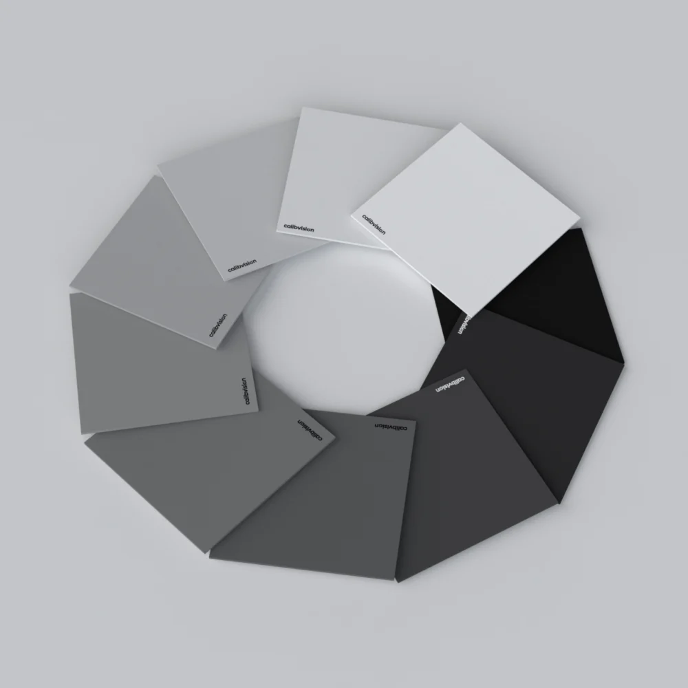
6. Choosing Reflectivity Levels for Automotive Testing
Selecting appropriate reflectance levels simulates real-world objects the LiDAR will encounter.
Real-World Object Reflectances (905nm LiDAR)
| Object Type | Typical Reflectance (905nm) | Automotive Context |
|---|---|---|
| Black rubber (tires) | 2-5% | Fallen tire debris on highway |
| Dark clothing | 8-15% | Pedestrians in dark attire |
| Asphalt (dry) | 10-15% | Road surface |
| Asphalt (wet) | 5-8% | Rainy conditions |
| Dark vehicle paint (black, navy) | 15-25% | Most common vehicle colors |
| Medium vehicle paint (red, blue, green) | 30-50% | Typical vehicles |
| Concrete | 40-60% | Barriers, buildings |
| Light vehicle paint (silver, white) | 70-90% | Popular vehicle colors |
| Retroreflective signs (ASTM Type I) | 60-80% | Standard road signs |
| Retroreflective signs (ASTM Type III) | 150-250% | High-performance signs (appears >100% due to retroreflection) |
Note: Retroreflective materials don’t follow Lambertian reflection—they return more light toward the source. For testing retroreflective detection, you need actual retroreflective samples, not diffuse reflectance standards.
Standard Test Configurations
Minimum viable test (Budget-constrained):
- 50% only – Verifies basic functionality
- Limitation: Doesn’t test dynamic range or worst-case scenarios
- Use case: Early development, quick troubleshooting
Automotive standard test (Recommended):
- 10%, 50%, 90% – Three-point dynamic range
- Simulates:
- 10% = Dark pedestrian/vehicle (worst case for detection)
- 50% = Average objects (typical scenario)
- 90% = Bright vehicles (saturation test)
- Cost: $3,000-5,000 for 1m size targets
- Meets: Most OEM validation requirements
Comprehensive test (Production validation):
- 10%, 20%, 30%, 50%, 70%, 90% – Six-point characterization
- Advantages:
- Detailed linearity verification
- Classification algorithm training data
- Catch non-linearities in intensity response
- Cost: $6,000-10,000
- Meets: ASIL-D safety requirements, regulatory compliance
Custom Reflectivities for Specific Scenarios
Scenario 1: Pedestrian Detection Focus
OEM Requirement: “Detect pedestrians in dark clothing at 80m”
Test strategy:
- Use 15% reflectance target (matches dark clothing)
- Size: Human torso dimensions (600×400mm)
- Position at 60m, 70m, 80m, 90m
- Find 95% detection rate threshold
- Pass if: Detection at ≥80m with >95% success rate
Order: Custom DRS-R15L-600×400 target
Scenario 2: Tunnel Exit Adaptation
Challenge: LiDAR must transition from dark tunnel (low ambient light) to bright sunlight while maintaining detection
Test strategy:
- 30% target (average vehicle reflectance)
- Test in controlled lighting:
- Dark (<10 lux)
- Transition (rapid change to 100,000 lux)
- Bright (full sunlight)
- Measure detection continuity during transition
- Pass if: No missed detections during 2-second transition window
Scenario 3: Tire/Road Distinction
Challenge: Distinguish between tire debris (safety hazard) and road surface
Test strategy:
- 5% target (black rubber tire)
- 12% target (dry asphalt)
- Position both at 50m, separated by 1m laterally
- Verify classification: 5% → “object”, 12% → “road”
- Pass if: 100% correct classification over 1000 scans
Order: Custom DRS-R05L and DRS-R12L targets
Regional Considerations
Europe:
- Pedestrian-heavy urban environments
- Emphasis on low-reflectance detection (10-15%)
- Typical spec: “Detect 15% target at 60m”
North America:
- Highway-speed scenarios dominate
- Longer range requirements (150-250m)
- Mix of reflectances: 10%, 50%, 90%
Asia (China, Japan):
- Dense traffic, close-range scenarios
- Near-range saturation testing critical (90% target at 5-10m)
- Quick response time requirements (<100ms detection latency)
Seasonal/Weather Adaptation
Summer (Dry conditions):
- Use standard reflectances (10%, 50%, 90%)
- Asphalt ≈ 12%
Winter (Wet/snow):
- Reduce low-reflectance target to 8% (wet asphalt)
- Add 95% target (simulates snow reflection)
- Test sensor’s ability to distinguish snow (95%, covers large area) from vehicles (70-90%, distinct shapes)
Rain/Fog:
- LiDAR range reduced by atmospheric scattering
- Use higher reflectances (30%, 70%, 95%) at shorter distances
- Test detection rate as “simulated fog” (use neutral density filters or increased test distance)
7. Target Sizing and Distance Requirements
Undersized targets cause calibration failures. Here’s how to calculate required target size.
The Physics: Beam Divergence
Automotive LiDAR emits a laser beam that diverges (spreads) as it travels:
Spot Diameter = Distance × tan(Beam Divergence Angle)
Example:
- Beam divergence: 0.1° (typical for automotive LiDAR)
- Distance: 100m
- Spot diameter: 100m × tan(0.1°) = 100m × 0.00175 = 0.175m = 17.5cm
Minimum Target Size Rule
Target must be ≥3× spot diameter to ensure majority of return signal comes from calibrated target (not background).
Calculation:
Min Target Size = 3 × Distance × tan(Beam Divergence)
Example (0.1° divergence):
| Distance | Spot Diameter | Min Target Size (3×) | Recommended Standard |
|---|---|---|---|
| 5m | 0.9cm | 2.6cm | A6 (105mm) ✓ |
| 10m | 1.7cm | 5.2cm | A5 (148mm) ✓ |
| 25m | 4.4cm | 13.1cm | A4 (210mm) ✓ |
| 50m | 8.7cm | 26.2cm | 500×500mm ✓ |
| 100m | 17.5cm | 52.4cm | 500×500mm (marginal), 1000×1000mm (better) |
| 150m | 26.2cm | 78.7cm | 1000×1000mm ✓ |
| 200m | 35.0cm | 104.9cm | 1500×2000mm (recommended) |
| 300m | 52.4cm | 157.3cm | 2000×3000mm or 3000×5000mm ✓ |
Beam Divergence for Common Automotive LiDAR
| LiDAR Type | Beam Divergence | Max Range | Target Size @ Max Range |
|---|---|---|---|
| Mechanical spinning (Velodyne) | 0.2-0.3° | 100-200m | 1-2m recommended |
| Solid-state flash (Ouster) | 0.1-0.2° | 50-100m | 0.5-1m recommended |
| MEMS scanning | 0.05-0.1° | 150-300m | 1-3m recommended |
| Fiber-based (Luminar) | 0.03-0.05° | 250m+ | 0.5-1m (tight beam) |
Check your LiDAR datasheet for exact beam divergence!
Multi-Point Return Considerations
For statistical confidence, you want multiple laser points to hit the target:
Minimum: 4 points (defines a plane) Better: 9+ points (enables outlier rejection) Ideal: 25+ points (robust statistics)
Scanning LiDAR pattern:
- Horizontal resolution: 0.1-0.5° between adjacent beams
- Vertical resolution: 0.2-2° between scan lines
Example: Velodyne VLP-16
- 16 vertical channels, spanning 30° FOV
- Vertical resolution: 2°
- Horizontal resolution: 0.2° (at 10 Hz rotation)
To get 4×4 = 16 points on target at 50m:
- Horizontal: Need 4 × 0.2° = 0.8° → 50m × tan(0.8°) = 70cm width
- Vertical: Need 4 × 2° = 8° → 50m × tan(8°) = 7m height(!!)
Problem: Vertical resolution too coarse, can’t get many vertical points.
Solution: Use wider target (1m × 1m) to maximize horizontal points, accept fewer vertical points.
Field of View Coverage
For camera-LiDAR fusion targets, you want target to subtend significant FOV:
Recommended: Target subtends 2-10° of sensor FOV
Example:
- LiDAR FOV: 30° horizontal × 20° vertical
- Target should subtend: 0.6-3° (for 2-10% coverage)
- At 50m distance: 50m × tan(3°) = 2.6m width
For fusion targets (DRS-F series):
- Larger is better (easier to detect geometric features)
- Typical: 1-2m size for 10-50m fusion calibration
Practical Target Selection Chart
Your testing distance determines target size:
| Your Max Test Distance | Minimum Target | Recommended Target | Calibvision Model |
|---|---|---|---|
| <10m | A5 (148mm) | A4 (210mm) | DRS-R[XX]L-A4 |
| 10-25m | A4 (210mm) | 500×500mm | DRS-R[XX]L-500 |
| 25-75m | 500×500mm | 1000×1000mm | DRS-R[XX]L-1000 |
| 75-150m | 1000×1000mm | 1500×2000mm | DRS-R[XX]L-1500 |
| 150-250m | 1500×2000mm | 2000×3000mm | DRS-XL[XX]-2000 |
| 250m+ | 2000×3000mm | 3000×5000mm | DRS-XL[XX]-3000 |
Cost vs. Performance Trade-offs
Budget scenario:
- Buy one 1m × 1m target
- Test up to 150m (marginal but workable)
- Cost: ~$1,500
Standard scenario:
- Buy appropriate sizes: 500mm for <50m, 1m for 50-100m, 2m for 100-200m
- Cost: ~$4,000
Professional scenario:
- Multiple large-format targets (2-3m) for all distances
- Ensures always >3× margin
- Cost: ~$12,000
ROI consideration: Undersized target → invalid calibration → vehicle recall risk ($50M+) Proper targets are cheap insurance.
8. Common LiDAR Wavelengths: 905nm vs 1550nm
Automotive LiDAR operates at two primary wavelengths, each with distinct characteristics.
905nm (Near-Infrared)
Advantages:
- ✓ Cheaper components (silicon photodetectors)
- ✓ Smaller, lighter systems
- ✓ Higher power possible (Class 1 eye-safe up to ~10mW average)
- ✓ Better performance in rain (less atmospheric absorption)
Disadvantages:
- ❌ Sunlight interference (solar spectrum peaks ~500nm but extends to 900nm)
- ❌ Maximum range limited by eye safety (~200m typical)
- ❌ Ambient light noise higher
Typical automotive use:
- Short/mid-range systems (50-150m)
- Cost-sensitive applications
- Urban/suburban driving
Calibration targets:
- Must be certified at 905nm ±50nm
- Visible-spectrum targets not suitable (reflectance differs by 20-40%)
- Order: DRS-R[XX]L series (LiDAR-specific)
1550nm (Short-Wave Infrared, SWIR)
Advantages:
- ✓ Eye-safe at much higher power (Class 1 up to ~1W average)
- ✓ Longer range possible (250-300m+)
- ✓ Minimal sunlight interference (solar spectrum drops sharply >1400nm)
- ✓ Better target discrimination (less ambient noise)
Disadvantages:
- ❌ More expensive (InGaAs detectors required)
- ❌ Atmospheric absorption (water vapor attenuates 1550nm)
- ❌ Worse performance in fog/rain (Mie scattering increases with wavelength)
- ❌ Larger optical components needed
Typical automotive use:
- Long-range highway autonomy (200m+)
- Premium/luxury vehicles
- Robotaxi applications
Calibration targets:
- Must be certified at 1550nm ±50nm
- 905nm targets may have ±10-30% different reflectance at 1550nm
- Order: DRS-R[XX]L series with explicit 1550nm calibration
Reflectance Differences: 905nm vs 1550nm
Many materials have wavelength-dependent reflectance:
| Material | Reflectance @ 905nm | Reflectance @ 1550nm | Difference |
|---|---|---|---|
| Water (liquid) | 2% | 8% | 4× higher |
| Vegetation (leaves) | 45% | 35% | -22% |
| Asphalt | 12% | 10% | -17% |
| Concrete | 55% | 50% | -9% |
| White paint | 85% | 80% | -6% |
| Black paint | 18% | 16% | -11% |
Implication: If you calibrate 905nm LiDAR using a target calibrated only at visible wavelengths, your reflectance estimates could be off by 20-40%.
Hybrid Systems (Dual-Wavelength)
Some advanced systems use both 905nm and 1550nm:
- 905nm: Short/mid-range, high resolution
- 1550nm: Long-range, safety-critical
Calibration requirement:
- Need separate target sets for each wavelength, OR
- Use DRS-F series (full spectrum 200-2000nm) for both
Verification: Test each wavelength independently—don’t assume calibration transfers between wavelengths.
Wavelength-Specific Environmental Effects
Rain attenuation:
- 905nm: ~0.1 dB/km per mm/hr rainfall rate
- 1550nm: ~0.2 dB/km per mm/hr
- 1550nm has 2× more rain attenuation
Testing implication: If testing 1550nm LiDAR in rain, reduce expected range by ~30% compared to dry conditions.
Fog attenuation (Mie scattering):
- Worse at longer wavelengths
- 1550nm range reduced more than 905nm in fog
- Use closer targets (50-100m) for fog testing
Sunlight:
- 905nm: Strong interference (need testing at dawn/dusk or shaded areas)
- 1550nm: Minimal interference (can test anytime)
9. Indoor vs Outdoor Testing Considerations
Each environment has unique advantages and challenges.
Indoor Testing
Advantages:
1. Controlled Conditions
- Temperature: ±1°C stability
- Humidity: Fixed (typically 40-60% RH)
- No wind (target stability)
- No sunlight interference
- Repeatable testing
2. Safety
- Controlled access (no public)
- No weather delays
- Year-round availability
3. Convenience
- Equipment storage on-site
- Power readily available
- Climate-controlled for operators
Limitations:
1. Distance Constraints
- Typical indoor facilities: 50-100m maximum length
- Long-range testing (>150m) not possible
- Cost to build/rent 200m+ indoor range: $$$
2. Multipath Reflections
- Walls create secondary returns
- Can confuse sensor (ghost targets)
- Mitigation: Use anechoic materials (radar-absorbing foam) on walls
3. Artificial Environment
- Doesn’t validate outdoor performance
- Miss temperature extremes
- Miss rain/fog/snow conditions
Best Practices:
✓ Use matte black walls (absorb LiDAR, minimize multipath) ✓ Elevate target off floor (avoid floor reflections) ✓ Test at multiple positions (avoid room resonances) ✓ Document room dimensions (for multipath analysis if needed) ✓ Control lighting (turn off if possible, or use IR-blocking lights)
Outdoor Testing
Advantages:
1. Long-Range Capability
- Test full 200-300m range
- Verify maximum performance
2. Real-World Conditions
- Temperature extremes: -20°C to +50°C
- Sunlight: Verify interference rejection
- Weather: Rain, fog, snow testing
- Authentic validation
3. Large Targets Easier
- 3m × 5m targets practical outdoors
- Can use vehicle-mounted test fixtures
Challenges:
1. Weather Variability
- Testing delayed by rain (unless testing rain performance!)
- Wind moves targets → measurement errors
- Temperature swings (morning vs afternoon)
2. Sunlight Interference
- 905nm LiDAR: Strong interference from direct sunlight
- Workaround: Test at dawn/dusk, or use sunshades
3. Target Stability
- Wind-induced vibration
- Ground settling (over multiple days)
- Thermal expansion of mounting fixtures
4. Safety & Logistics
- Need closed test track or private land
- Weather monitoring equipment
- Transport large targets to/from site
Best Practices:
✓ Anchor targets securely: Sandbags, ground stakes, guy wires ✓ Use sunshade canopy: Especially for 905nm LiDAR ✓ Allow thermal stabilization: 30 min for target to reach ambient temp ✓ Record environmental data: Temp, humidity, wind speed, solar angle ✓ Multiple test days: Average results across different conditions ✓ Morning testing: Calmest winds, lowest temperature gradients
Hybrid Approach (Recommended)
Phase 1: Indoor Development (Weeks 1-4)
- Initial calibration
- Algorithm tuning
- Repeatability verification
- Controlled experiments
Phase 2: Outdoor Validation (Weeks 5-8)
- Long-range testing
- Environmental robustness
- Real-world scenario simulation
- Final acceptance testing
Phase 3: Ongoing (Production)
- Indoor: Quick regression testing after firmware updates
- Outdoor: Annual validation, regulatory compliance
Seasonal Considerations (Outdoor)
Spring/Fall (Recommended):
- Moderate temperatures (10-25°C)
- Lower humidity than summer
- Generally calm winds
- Best testing conditions
Summer:
- High temperatures (30-40°C target surface in sunlight)
- Heat shimmer affects long-range measurements
- Thunderstorm risk (halt testing during lightning)
- Mitigation: Test early morning (6-9 AM)
Winter:
- Cold temperatures (test sensor thermal performance)
- Snow on ground (95% reflectance, tests dynamic range)
- Shorter daylight hours
- Benefits: Low ambient humidity, crisp air (good visibility)
Never test in:
- Heavy rain (unless specifically testing rain performance)
- High winds (>15 mph / 25 km/h) – target vibration
- Fog (unless specifically testing fog performance)
- Lightning storms (safety risk)
10. Environmental Factors and Corrections
Environmental conditions affect LiDAR performance and calibration measurements.
Temperature Effects
1. Sensor Internal Temperature
Impact:
- Laser output power changes with temperature (typically -0.3%/°C)
- Detector sensitivity changes (±0.1%/°C)
- Timing circuits drift (affects range accuracy)
Automotive spec: Operate -40°C to +85°C
Testing:
- Baseline calibration at 20-25°C (room temperature)
- Re-test at temperature extremes (if environmental chamber available)
- Verify sensor temperature compensation is working
Expected drift (with compensation):
- Range: <5mm over full temperature range
- Intensity: <10% over full temperature range
If drift exceeds this: Temperature compensation may not be enabled or properly tuned.
2. Target Surface Temperature
Impact:
- Thermal expansion changes target dimensions (negligible for rigid substrates)
- Some coating materials have temperature-dependent reflectance (±0.01%/°C typical for quality targets)
Outdoor testing:
- Target in direct sunlight: Surface temperature can reach 60-70°C
- Target in shade: Ambient temperature (25-30°C)
- Temperature difference: 30-40°C → 0.3-0.4% reflectance change
Mitigation:
- Allow 30-minute stabilization after moving target into position
- Record target surface temperature (IR thermometer)
- Apply correction per calibration certificate (if provided)
- Prefer early morning testing (lowest thermal gradients)
3. Air Temperature & Atmospheric Effects
Impact:
- Speed of light changes with air density: c_air = c_vacuum / n(T, P, RH)
- Range measurements affected by ~1 ppm per °C
Example:
- 100m range, 20°C temperature change
- Error: 100m × 20 × 1e-6 = 2mm
Typical: This is much smaller than other error sources, generally ignored unless doing precision metrology (±1mm requirements).
Humidity Effects
1. Atmospheric Absorption
Impact:
- Water vapor absorbs IR light (worse at 1550nm than 905nm)
- Range reduced in high humidity
Example (1550nm LiDAR):
- Dry air (20% RH): Maximum range 250m to 90% target
- Humid air (90% RH): Maximum range reduced to 220m (-12%)
905nm less affected: ~2-3% range reduction at high humidity
Testing:
- Record relative humidity during outdoor tests
- Note if testing in fog/mist (extreme case: 100% RH)
- Expect reduced range in humid conditions
2. Condensation on Optics
Impact:
- Moisture on LiDAR window or target surface scatters light
- Range accuracy degrades, intensity measurements invalid
Prevention:
- Wipe optics before testing
- Allow sensor to acclimate (avoid moving cold sensor into warm, humid environment)
- Use anti-fog coating on LiDAR window (if available)
If condensation forms:
- Stop testing, dry optics thoroughly
- Re-calibrate (condensation may have shifted zero point)
Atmospheric Scattering (Rain/Fog/Snow)
Rain:
- Light rain (1-5 mm/hr): 10-20% range reduction
- Moderate rain (5-20 mm/hr): 30-50% range reduction
- Heavy rain (>20 mm/hr): >50% range reduction, sensor may fail to detect
Testing in rain:
- Intentional (validation of rain performance) OR
- Unintentional (postpone testing if possible)
If testing in rain:
- Use higher reflectance targets (70%, 90%) – lower targets may be below detection threshold
- Reduce test distances (50-100m instead of 150-200m)
- Record rainfall rate (mm/hr)
- Document as “rain performance test” not “baseline calibration”
Fog:
- Worse than rain (Mie scattering from suspended droplets)
- Visibility <50m: LiDAR range typically <30-40m
- Recommendation: Postpone testing unless specifically characterizing fog performance
Snow:
- Falling snow: Similar to fog (scattering)
- Snow on ground: 95% reflectance, very bright target
- Testing opportunity: Verify sensor dynamic range (can it distinguish vehicle at 80% vs. snow at 95%?)
Sunlight Interference
Problem (905nm LiDAR):
- Solar spectrum includes 905nm wavelength
- Direct sunlight on detector causes noise → reduced SNR → shorter range
Impact:
- Midday sun (100,000 lux): Range reduced by 20-40% vs. nighttime
- Sensor may report false detections (sunlight reflections off surfaces)
Testing strategies:
Option 1: Dawn/Dusk Testing
- Sun below horizon (civil twilight)
- <1,000 lux ambient
- LiDAR performance similar to nighttime
- Recommended time: 30 minutes before sunrise to 30 minutes after sunrise
Option 2: Sunshade
- Block direct sunlight from sensor and target
- Use opaque canopy (blocks >99% sunlight)
- Ensure shade doesn’t interfere with laser beam path
Option 3: Midday Testing (Intentional)
- Validate “worst-case” sunlight interference
- Verify sensor can still detect 10% target at 50m in full sun
- Document as “high-ambient-light test”
1550nm LiDAR:
- Much less affected (solar spectrum drops sharply >1400nm)
- Can test anytime without sunlight concerns
Ground Reflections (Multipath)
Problem:
- Laser beam hits target, reflects to receiver (primary return) ✓
- Small amount reflects off target, hits ground, reflects back to receiver (secondary return) ❌
- Secondary return arrives slightly delayed → appears as false target behind actual target
Detection:
- See “ghost targets” 0.5-2m behind actual target
- More common with high-reflectance targets (90%)
- More common at oblique angles (target tilted)
Mitigation:
- Use matte black ground surface beneath target (absorbs multipath)
- Elevate target 1-2m off ground
- Mount target perpendicular to sensor (minimize ground reflection geometry)
If multipath detected:
- Not a calibration issue (it’s a sensor firmware issue – should filter multipath)
- Document and report to manufacturer
Electromagnetic Interference (EMI)
Sources:
- High-voltage power lines (>100kV)
- Radio/TV transmitters
- Radar installations
- Other LiDAR sensors (if testing multiple simultaneously)
Symptoms:
- Increased measurement noise (large std deviation)
- Occasional outlier measurements
- Intermittent “no detection” despite target in range
Detection:
- Compare measurement repeatability in test site vs. known-good location
- Use EMI detector to scan for RF noise
Mitigation:
- Move test location away from interference sources
- Use shielded cables for sensor power and data
- Test during off-peak hours (less radio traffic)
Correcting for Environmental Conditions
Best practice: Document everything
For each calibration test, record:
- ✓ Ambient temperature (°C)
- ✓ Target surface temperature (°C)
- ✓ Relative humidity (%)
- ✓ Barometric pressure (if available)
- ✓ Wind speed and direction
- ✓ Ambient light level (lux)
- ✓ Weather conditions (clear, rain, fog, snow)
- ✓ Solar angle (azimuth, elevation)
- ✓ Time of day
When comparing results: If calibration at Time 1 differs from Time 2, environmental log helps determine cause:
- Temperature changed 30°C → likely thermal effect
- Humidity changed from 30% to 90% → likely atmospheric absorption (1550nm LiDAR)
- Clear vs. fog → obvious (scattering)
Applying corrections: Most automotive LiDAR has built-in temperature compensation. You typically don’t apply manual corrections—just verify that sensor’s internal compensation is working properly.
11. Case Study: Automotive LiDAR Validation
Let’s walk through a real-world automotive LiDAR calibration project.
Project Overview
Client: Tier-1 automotive supplier developing ADAS system for European OEM LiDAR: Solid-state MEMS scanning, 905nm, 150m range (claimed) Application: Highway lane-keeping (SAE Level 3) Requirement: Detect 15% reflectance pedestrian at 100m with >98% success rate
Phase 1: Indoor Initial Calibration (Week 1)
Facility: 75m indoor test range Targets: DRS-R10L-1000, DRS-R50L-1000, DRS-R90L-1000 (1m × 1m, 905nm calibrated)
Day 1-2: Range Calibration
- Tested 90% target at: 10m, 25m, 50m, 75m
- Used Leica DISTO laser rangefinder for ground truth
- Results:
- All range errors <10mm ✓
- Repeatability (2σ) <15mm ✓
- Passed range accuracy specification
Day 3-4: Intensity Calibration
- Fixed distance: 50m
- Tested 10%, 50%, 90% targets sequentially
- Results:
- Intensity ratios within ±3% of theoretical ✓
- Linear regression R² = 0.9995 ✓
- Passed intensity linearity specification
Day 5: Dynamic Range Testing
- 10% target: Detected reliably to 70m (limited by indoor range)
- 50% target: Detected to 75m (facility maximum)
- 90% target: Detected to 75m, no saturation at 10m ✓
Decision: Indoor validation successful → proceed to outdoor long-range testing
Phase 2: Outdoor Long-Range Validation (Week 2-3)
Location: Closed automotive test track, flat terrain, 300m straightaway Targets: DRS-R10L-2000×3000, DRS-R50L-2000×3000, DRS-R90L-2000×3000 (large format)
Week 2: Initial Outdoor Testing
Day 1: Setup & Baseline
- Mounted targets on heavy-duty stands
- Anchored with sandbags (wind gusts to 15 mph expected)
- Positioned 90% target at 100m for baseline verification
- Weather: Sunny, 22°C, 45% RH, light breeze
Results:
- Range error at 100m: +12mm ✓ (consistent with indoor)
- Intensity: Consistent with indoor (after accounting for temperature difference)
- Validation: Outdoor setup matches indoor performance
Day 2-3: 10% Target Range Finding
- Goal: Find maximum detection range for 15% target (pedestrian simulation)
- Note: Used 10% target (worst case; 15% custom target on order)
Test sequence:
- 50m: 100% detection rate ✓
- 75m: 100% detection rate ✓
- 100m: 99.2% detection rate ✓ Target specification: 98% at 100m for 15% target
- 110m: 96.8% detection rate ⚠️ Below 98%
- 120m: 89.4% detection rate ❌ Well below spec
Conclusion:
- With 10% target: Reliable detection to 100m ✓
- With 15% target (25% more signal): Expected ~110-115m
- ISSUE: Specification calls for 100m with 15% target → PASS (with margin)
Day 4: Sunlight Interference Testing
- Goal: Verify performance degrades gracefully under sunlight
- Method: Repeat 10% target at 100m at different times:
- 6:00 AM (dawn): <100 lux
- 12:00 PM (noon): 100,000 lux, sun ~30° behind sensor
- 4:00 PM (afternoon): 80,000 lux, sun angle changed
Results:
| Time | Ambient Light | Detection Rate (10% @ 100m) | Range Error | Notes |
|---|---|---|---|---|
| 6 AM | <100 lux | 99.5% | +11mm | Baseline ✓ |
| 12 PM | 100,000 lux | 94.2% | +18mm | ⚠️ Degraded |
| 4 PM | 80,000 lux | 96.8% | +14mm | Better than noon |
Analysis:
- Sunlight causes 5% reduction in detection rate (99.5% → 94.2%)
- Still above 90% threshold (acceptable for Level 3 autonomy)
- Worse at noon when sun angle aligns with sensor boresight
- Recommendation: Document sunlight performance, consider algorithmic improvements
Week 3: Environmental Robustness Testing
Day 5: Temperature Extremes
- Morning test (8°C ambient):
- LiDAR cold-soaked overnight in vehicle
- 10% target at 100m: 97.8% detection rate ⚠️ (vs. 99.2% at 22°C)
- Issue: Sensor not yet thermally stabilized
- After 30 min warm-up: 99.1% detection rate ✓
Action: Added “30-minute warm-up requirement” to operating procedures
- Afternoon test (38°C ambient, target in sun):
- Target surface temperature: 65°C (IR measurement)
- 10% target at 100m: 99.0% detection rate ✓
- Conclusion: Hot target does not significantly affect detection
Day 6: Light Rain Testing
- Weather: Light rain, 3 mm/hr, 95% RH, 18°C
- Test: 10% target at 100m
Results:
- Detection rate: 91.5% ❌ (vs. 99.2% dry)
- Range error: +25mm (vs. +12mm dry)
- Point cloud shows “clutter” from raindrops
Analysis:
- Rain reduces detection rate by ~8%
- Still >90% (acceptable for Level 3, which requires driver takeover in heavy rain)
- Passed rain performance specification
Day 7: Multi-Target Simultaneous Detection
- Setup:
- 10% target at 100m (simulated pedestrian)
- 50% target at 80m (simulated vehicle)
- 90% target at 60m (simulated white vehicle)
- All three visible simultaneously in LiDAR FOV, separated by 5° azimuth
Results:
- All three targets detected simultaneously: ✓
- Detection rates:
- 10% @ 100m: 98.9% ✓
- 50% @ 80m: 100% ✓
- 90% @ 60m: 100% ✓
- No cross-talk (each target’s intensity correct) ✓
- No AGC issues (bright target didn’t overwhelm dim target) ✓
Conclusion: Multi-target dynamic range validation passed
Phase 3: Final Acceptance & Documentation (Week 4)
Day 8-9: Repeatability Testing
- Repeated key tests (10% @ 100m baseline) on 5 separate occasions
- Different times of day, different environmental conditions
Results:
- Detection rate: 97.8% to 99.5% (mean 98.9%) ✓
- Range error: +8mm to +16mm (mean +12mm) ✓
- Excellent repeatability across conditions
Day 10: Compilation & Reporting
- Created calibration report with:
- Test procedures
- Results tables and graphs
- Environmental conditions log
- Pass/fail against specifications
- Calibration certificates for all targets (NIST-traceable)
- Photos of test setup
- Recommendations for production testing
Final Verdict:
- Range accuracy: ✓ Passed (±20mm at 100m, spec was ±20mm)
- Intensity calibration: ✓ Passed (linearity R² >0.999, spec was >0.99)
- Detection performance: ✓ Passed (>98% for 10% at 100m, extrapolates to >99% for 15% at 100m)
- Environmental robustness: ✓ Passed (light rain, temperature extremes, sunlight)
- Multi-target: ✓ Passed (no cross-talk or AGC issues)
Overall: PASSED – LiDAR meets specifications for SAE Level 3 highway autonomy
Lessons Learned
1. Indoor vs. Outdoor Correlation
- Indoor calibration was accurate predictor of outdoor performance
- Saved time by doing initial development indoors
2. Target Size Matters
- Initial plan used 1m targets for 100m testing (adequate but marginal)
- Upgraded to 2m × 3m targets → more reliable measurements
- Investment paid off in confidence in results
3. Environmental Documentation Critical
- Weather variability caused 5-10% performance swings
- Detailed logging allowed root cause analysis
- Enabled “apples-to-apples” comparison across test days
4. Sunlight Interference Real
- 905nm LiDAR showed clear sunlight sensitivity
- Testing at multiple times of day revealed issue
- Client decided to add “sun angle” to operating domain definition
5. Reflectance Standards are Essential
- Precise, traceable targets enabled quantitative validation
- Gray cards or uncalibrated targets would have given ±20% uncertainty
- $5K investment in targets enabled $100M+ product validation
12. Troubleshooting Common Calibration Issues
When calibration doesn’t go as planned, use this guide to diagnose and resolve issues.
Issue #1: Inconsistent Range Measurements
Symptoms:
- Large standard deviation (σ > 5% of distance)
- Measurements jumping around (e.g., 50.0m, 50.3m, 49.8m, 50.5m…)
- No obvious pattern
Possible Causes & Solutions:
A. Target Vibration
- Diagnosis: Visually observe target—does it move in wind?
- Solution:
- Add mass (sandbags on base)
- Guy wires to stabilize
- Test during calm conditions
B. Target Too Small
- Diagnosis: Calculate spot size (Distance × tan(Beam Divergence))
- If target < 3× spot size → signal contaminated by background
- Solution: Use larger target
C. Multipath Reflections
- Diagnosis: See “ghost” targets offset from main target
- Occurs more often indoors or near reflective surfaces
- Solution:
- Move target away from walls
- Use matte black surfaces nearby
- Elevate target off ground
D. Electrical Noise/EMI
- Diagnosis: Check environment—power lines nearby? Other LiDAR/radar?
- Solution:
- Move test location
- Shield sensor power/data cables
- Test at different time (EMI may be intermittent)
E. Sensor Internal Issue
- Diagnosis: If problem persists across multiple test setups, likely sensor
- Solution: Contact manufacturer, possible RMA needed
Issue #2: Systematic Range Offset
Symptoms:
- All measurements shifted by constant amount (e.g., always +2cm high)
- Consistent across distances
Possible Causes & Solutions:
A. Measurement Reference Point Error
- Diagnosis: Where are you measuring “distance” from? LiDAR has internal offset from housing to optical aperture
- Solution: Check datasheet for correct reference point, adjust ground truth measurements
B. Time-of-Flight Zero Calibration
- Diagnosis: Internal sensor calibration issue
- Solution:
- Check if sensor has “zero offset” adjustment in software
- Apply correction factor if allowed
- If sealed unit, may need manufacturer recalibration
C. Temperature Effect
- Diagnosis: Did ambient temperature change significantly from previous calibration?
- Solution: Verify sensor temperature compensation enabled, test at multiple temperatures
Issue #3: Distance-Dependent Range Error
Symptoms:
- Error increases with distance (e.g., +5mm at 10m, +30mm at 100m)
Possible Causes & Solutions:
A. Speed of Light Constant Incorrect
- Diagnosis: Speed of light varies slightly with temperature/pressure
- Solution: Record environmental conditions, apply atmospheric correction (usually small, ~1 ppm/°C)
B. Clock Frequency Drift
- Diagnosis: Time-of-flight clock running slightly fast/slow
- Solution: Manufacturer recalibration needed (internal clock adjustment)
C. Non-Linearity in Timing Circuit
- Diagnosis: Plot range error vs. distance—is it linear or curved?
- Solution: If curved (non-linear), sensor firmware may need multi-point calibration correction
Issue #4: Intensity Values Don’t Match Expected Reflectance
Symptoms:
- 50% target returns same intensity as 90% target
- Or intensity ratios way off (90/10 = 3× instead of 9×)
Possible Causes & Solutions:
A. Saturation
- Diagnosis: At close range or high reflectance, detector saturates (clipping)
- All high-reflectance targets report same “maximum” intensity
- Solution:
- Move target farther away
- Use lower reflectance targets for close-range testing
- Check if sensor has “high dynamic range” mode
B. Automatic Gain Control (AGC) Issue
- Diagnosis: Sensor adjusts gain based on scene brightness, corrupting intensity measurements
- Solution:
- Check if AGC can be disabled (for calibration only)
- Test single target at a time (avoid bright/dim targets simultaneously)
- Document AGC behavior for manufacturer
C. Wrong Wavelength Calibration
- Diagnosis: Are you using targets calibrated at sensor’s wavelength?
- 905nm target may have different reflectance at 1550nm
- Solution: Verify target calibration certificate matches sensor wavelength (±50nm)
D. Background Contamination
- Diagnosis: If target too small, background (road/grass/sky) contaminates measurement
- Solution: Use larger target (3× spot size minimum)
Issue #5: Low Detection Rate
Symptoms:
- Target only detected in 50-80% of scans (should be >95%)
Possible Causes & Solutions:
A. Target Too Far
- Diagnosis: Beyond sensor’s maximum range for that reflectance
- Solution: Move closer or use higher reflectance target
B. Low Signal-to-Noise Ratio
- Diagnosis: Check ambient conditions—bright sunlight? Fog?
- Solution:
- Test at dawn/dusk (less sunlight interference)
- Wait for clear weather
- Use higher reflectance target
C. Target Misaligned
- Diagnosis: Is target centered in sensor FOV?
- Is target perpendicular to sensor, or at extreme angle?
- Solution: Re-align target, verify with sensor’s FOV visualization
D. Beam Walking Off Target
- Diagnosis: As sensor scans, does beam pass across target or just clip edge?
- For small targets at long range, beam may only intersect target in portion of scan cycle
- Solution: Use larger target
Issue #6: Results Not Repeatable Day-to-Day
Symptoms:
- Monday’s calibration: Range error +5mm
- Tuesday’s calibration (same setup): Range error +20mm
Possible Causes & Solutions:
A. Environmental Changes
- Diagnosis: Check environmental log—did temperature, humidity, or weather change?
- Solution: Document environment, test under consistent conditions, or account for known effects
B. Target Position Shifted
- Diagnosis: Did someone move target between test sessions?
- Measure distance with laser rangefinder each time
- Solution: Mark target position on ground, verify distance every session
C. Sensor Drift/Warm-Up
- Diagnosis: Is sensor thermally stabilized?
- Some sensors need 15-30 min warm-up after power-on
- Solution: Always allow warm-up period before calibration
D. Inconsistent Data Collection
- Diagnosis: Are you collecting same number of samples? Same processing method?
- Solution: Document data collection procedure, follow consistently
Issue #7: Can’t Get LiDAR to Detect Target
Symptoms:
- No detections at all, even at close range with high-reflectance target
Possible Causes & Solutions:
A. Sensor Not Operating
- Diagnosis: Is laser emitting? (Careful—don’t look directly into laser!)
- Check power, data connections, LED status indicators
- Solution: Verify sensor boot-up sequence, check manufacturer documentation
B. Target Outside Field of View
- Diagnosis: LiDAR has limited FOV (e.g., 120° × 25°)
- Is target positioned within FOV?
- Solution: Use sensor’s live view / visualization tool to locate target
C. Wrong Data Interpretation
- Diagnosis: Are you looking at correct data stream?
- Some LiDAR outputs: raw points, filtered points, object list
- Solution: Review data format, ensure parsing correctly
D. Target Specular, Not Diffuse
- Diagnosis: If using wrong “target” (e.g., mirror, glossy surface)
- Specular reflection goes away from sensor, no return
- Solution: Use proper diffuse reflectance standard
When to Escalate to Manufacturer
Contact LiDAR manufacturer if:
- Range errors >5× specification persist across all test conditions
- Intensity calibration completely non-linear (R² < 0.9)
- Sensor behavior changes drastically after firmware update
- Internal error codes/warnings appear
- You suspect hardware failure (e.g., optics contamination, laser power drop)
Provide:
- Detailed test setup description
- Environmental conditions
- Raw data files (if available)
- Photos of test setup
- Calibration certificates for targets used
13. Compliance and Documentation
Proper documentation ensures traceability, regulatory compliance, and repeatability.
Required Documentation
1. Test Plan
- Objectives (what you’re calibrating/validating)
- Test procedures (step-by-step)
- Pass/fail criteria
- Equipment list
- Schedule
2. Equipment List
- LiDAR sensor (model, serial number, firmware version)
- Reflectance standards (model, serial numbers, calibration dates)
- Laser rangefinder or total station (model, calibration date)
- Environmental sensors
- Software tools and versions
3. Calibration Certificates
- For each reflectance standard used
- Must include:
- Serial number
- Reflectance values at test wavelength
- Measurement uncertainty
- Traceability statement (NIST/PTB)
- Calibration date and recommended re-cal date
- Lambertian conformity data
4. Test Results
- Raw data files (all measurements)
- Summary tables (range error, intensity, detection rate)
- Graphs (range error vs. distance, intensity linearity)
- Statistical analysis (mean, std dev, pass/fail)
5. Environmental Log
- Date, time of each test
- Temperature (ambient, target surface)
- Humidity
- Weather conditions
- Wind speed
- Ambient light level
- Any unusual conditions (EMI, nearby construction, etc.)
6. Photos/Videos
- Test setup (sensor position, target position)
- Target mounting (show stability)
- Environmental conditions (weather, lighting)
- Annotate with distances, angles
7. Calibration Report
- Executive summary (pass/fail, key findings)
- Detailed results by test section
- Analysis and interpretation
- Recommendations
- Signature and date (test engineer)
ISO 26262 Compliance
For automotive functional safety (ASIL-B to ASIL-D systems):
Required:
- ✓ Traceable calibration equipment (targets NIST/PTB-traceable)
- ✓ Calibration equipment accuracy ≥3× better than device under test
- ✓ Documented procedures (work instructions)
- ✓ Training records (who performed calibration?)
- ✓ Measurement uncertainty analysis
- ✓ Re-calibration intervals defined
- ✓ Non-conformance handling (what if calibration fails?)
Calibvision DRS targets meet ISO 26262 requirements:
- ±2% accuracy (3-5× better than typical ±5-10% LiDAR intensity spec)
- NIST-traceable calibration certificates
- Documented traceability chain
- Recommended re-cal intervals provided
Data Retention
How long to keep calibration records:
During development: Indefinitely (reference for future work)
Production vehicles:
- Minimum: Product lifetime + 10 years (liability reasons)
- Some jurisdictions: 15-20 years for safety systems
- Recommendation: Permanent archive (digital storage cheap)
What to archive:
- All raw data (point clouds if possible, summary statistics at minimum)
- Calibration certificates (PDF)
- Photos/videos
- Environmental logs
- Final report
Storage format:
- Non-proprietary (CSV, PDF, JPG—not obscure binary formats)
- Multiple backups (on-site, off-site, cloud)
- Indexed/searchable (can find specific test by date, serial number, etc.)
Audit Preparedness
OEM or regulatory auditors may request:
- Calibration procedures (work instructions)
- Traceability documentation (calibration certificates)
- Sample calculations (range error, intensity ratio)
- Equipment calibration status (is laser rangefinder itself calibrated?)
- Training records (who is authorized to perform calibration?)
Be prepared to demonstrate:
- Equipment is within calibration interval
- Procedures are followed consistently
- Results are traceable and reproducible
- Non-conformances are documented and addressed
14. Conclusion
LiDAR calibration using diffuse reflectance standards is the cornerstone of autonomous vehicle safety validation. From verifying basic range accuracy to characterizing performance across environmental extremes, these precision optical targets enable traceable, repeatable measurements that regulatory bodies and OEMs demand.
Key Takeaways
1. Calibration is Multi-Dimensional
- Range accuracy (distance)
- Intensity calibration (reflectance)
- Dynamic range (low to high reflectance)
- Environmental robustness (temperature, weather, sunlight)
- All must be validated for comprehensive system qualification
2. Target Selection Matters
- Match wavelength to sensor (905nm or 1550nm)
- Size targets appropriately (≥3× spot diameter)
- Use NIST-traceable standards (±2% accuracy for automotive)
- Standard configuration: 10%, 50%, 90% reflectance
3. Indoor & Outdoor Testing Complement Each Other
- Indoor: Controlled, repeatable, development-phase testing
- Outdoor: Real-world conditions, long-range, validation-phase testing
- Hybrid approach recommended for comprehensive validation
4. Environmental Factors are Significant
- Temperature affects sensor and target (±0.3%/°C typical)
- Sunlight interferes with 905nm LiDAR (test at dawn/dusk or use shade)
- Rain/fog reduce range by 30-50% (test limits of operational domain)
- Document everything—enables root cause analysis
5. Troubleshooting is Systematic
- Large std deviation → vibration, multipath, or EMI
- Systematic offset → reference point or zero calibration error
- Poor detection rate → target too far, too small, or environmental interference
- Intensity issues → saturation, AGC, wrong wavelength, or background contamination
6. Documentation Ensures Compliance
- ISO 26262 requires traceable calibration for safety systems
- Keep calibration certificates, raw data, environmental logs, photos
- Archive for product lifetime + 10 years minimum
- Audit-ready documentation protects against liability
Next Steps for Your Project
If starting LiDAR calibration:
- Review sensor specifications (wavelength, range, accuracy requirements)
- Select targets: Wavelength-matched, appropriate size, 10%/50%/90% minimum
- Plan test facility (indoor for <100m, outdoor for longer range)
- Document procedures before starting testing
- Budget for time (1-2 weeks indoor, 2-4 weeks outdoor typical)
If troubleshooting existing calibration:
- Check target size vs. distance (often overlooked)
- Verify wavelength match (905nm sensor needs 905nm-calibrated targets)
- Review environmental log (temperature/sunlight/weather effects)
- Verify targets are within calibration interval (re-cal if expired)
- Contact Calibvision applications engineering for expert consultation
If preparing for regulatory approval:
- Ensure all targets have NIST/PTB-traceable calibration
- Document traceability chain (target cert → your measurements → sensor validation)
- Compile comprehensive test report with all supporting data
- Review ISO 26262 requirements for your ASIL level
- Prepare for audit (equipment calibration status, procedures, training records)
Investment Justification
Cost of proper calibration:
- Targets: $3,000-15,000 (depending on size/quantity)
- Test facility rental: $1,000-5,000/week
- Engineer time: 2-6 weeks
- Total: $20,000-100,000
Cost of improper calibration:
- Vehicle recall: $50M-500M (depending on units, severity)
- Liability from safety incident: Potentially catastrophic
- Regulatory non-compliance: Delayed launch, lost revenue
ROI is clear: Proper calibration is cheap insurance for billion-dollar programs.
Calibvision Support
We’re here to help:
- Application engineering consultations: Help select right targets for your application
- Custom target design: Non-standard sizes, reflectivities, or configurations
- On-site calibration services: For large installations or special requirements
- Training workshops: Hands-on calibration training for your team
Contact us:
- Technical Support: support@calibvision.com
- Sales: sales@calibvision.com
- Phone: +86-XXX-XXXX-XXXX
→ Explore Calibvision DRS Series for Automotive LiDAR
Further Reading
Calibvision Resources:
- Main Guide: Diffuse Reflectance Standards Complete Guide
- Understanding Lambertian Reflectance
- Reflectance Standards Comparison: Which Type to Choose?
- Manufacturing Quality: Why Cleanroom Standards Matter
Industry Standards:
- ISO 26262: Road vehicles — Functional safety
- SAE J3016: Taxonomy and Definitions for Terms Related to Driving Automation Systems
- ISO 14129: Optics and photonics — Calibration of optical transfer function measurement systems
- ASTM E1347: Standard Test Method for Color and Color-Difference Measurement
Technical References:
- Hecht, E. (2016). Optics (5th ed.). Pearson. (Chapter on scattering and reflection)
- Peynot, T. et al. (2010). “Characterisation of the Sick LMS151 Laser Rangefinder for Navigation Tasks,” IEEE/RSJ International Conference on Intelligent Robots and Systems
- Jelalian, A.V. (1992). Laser Radar Systems. Artech House. (Chapter 3: Laser radar equation)
Last updated: January 2025. Procedures subject to updates as LiDAR technology and regulatory requirements evolve.